
Work With Us

The system in the first phase must make a study of the forest to collect data in which we will determine what are the normal values of the area either in the seismic area and the acoustic area. We start the first phase with a total of 20 sensors every 8 km which will be connected to a satellite network for real-time monitoring either through the LANDSAT 8/OLI or AMAZONA 3 satellites.

In the second phase, with the results of the previous phase, the pertinent adjustments will be made and the system will be expanded to cover more areas of the forest and this system will be carried out with a team specialized in the subject in conjunction with the government system. A database will be implemented with the reports of nomalias and the system will be carried out in conjunction with the neighboring government to have a control
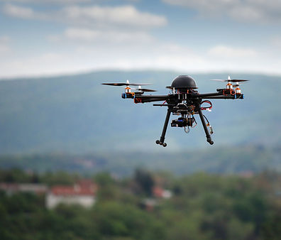
For the third phase in this phase we will implement the use of drones to increase the level of certainty and precision of the work that is being carried out with the drones we will use quadcopters and airplanes since with these we will obtain high quality images.
Flores, F. (2020, December 5). Drones: ¿Cuál es el mejor del 2021? ZONATECH. https://www.zonatech.es/drones/

In the fourth phase, Panama will implement its own satellite to have better accuracy in data management and development of new projects.